
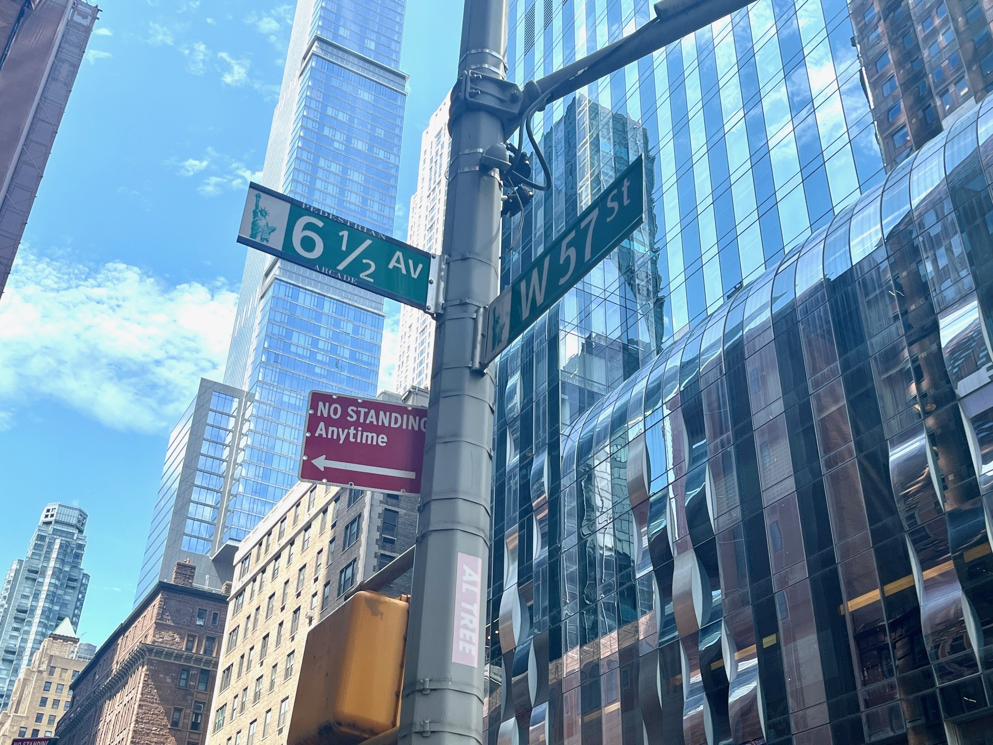
There is exactly one fractional avenue in New York City’s grid, and it runs through our neighborhood. The green signs read 6 1/2 AV. It stretches a quarter mile up the middle of our blocks, from West 51st to West 57th Street, threading between Sixth and Seventh Avenues through a chain of arcades, lobbies, and covered passages. Most people who use it every day have no idea it exists on paper. Fewer still know that this neighborhood helped invent it, twice.
Act one: the deal
The story starts with a trade. New York’s 1961 Zoning Resolution let developers build bigger towers in exchange for giving something back to the street: plazas, arcades, and passages open to the public, a category now known as privately owned public spaces, or POPS. In the 1980s, as a generation of towers rose between Sixth and Seventh, Community Board 5 negotiated those through-block passages one building at a time.
Tama Starr, now a director of this association, sat on CB5 in those years. “CB5 considered them a worthy amenity for residents and workers, especially in winter, and a welcome traffic expediter, freeing up Avenue sidewalks by giving pedestrians an alternative route,” she recalls. “Even at the price of the additional FAR, we considered the plan worthwhile and were glad to be a part of it. A nice example of public-private cooperation.”
The towers got their extra floors. The public got a hidden corridor, six blocks of it, with no name, no signs, and no way to cross the streets in between.
Act two: the fight
For thirty years the passages stayed a local secret, useful mainly to office workers dodging winter wind. Then in 2011 a group called Friends of Privately Owned Public Spaces came to our association, then still the West 54-55 Street Block Association, with an idea: connect the passages into a single named walk. The early proposal would have called it Holly Whyte Way, after William H. Whyte, the great observer of how New Yorkers actually use public space.
The group’s founder, Brian Nesin, had begun exploring the passages after the 2008 financial crisis slowed his practice. In 2011 the group staged a parade through the arcades led by the artist Graham Coreil-Allen, an outing that required a permit from the Midtown North precinct and some effort convincing the NYPD that a parade through office lobbies was not part of the Occupy movement.
Daly Reville, our Vice President, was serving on CB5’s Transportation Committee at the time, and the association took up the cause. It took a campaign to get the community board to recommend that the Department of Transportation study the idea, and another to get the proposal approved. In May 2011 CB5 formally requested that DOT examine the corridor. In March 2012 DOT came back with a plan, and the full board voted in favor. Nor was the city a reluctant partner: Daly recalls that the department under Sadik-Khan was genuinely excited once CB5 finally voted to have the corridor studied and then implemented. That summer, under Mayor Bloomberg and DOT Commissioner Janette Sadik-Khan, crews installed high-visibility crosswalks, pedestrian ramps, reflective markers, stop signs at six crossings, a signal at 57th Street, and the street signs that made it official. Before the project, DOT had counted up to 1,200 pedestrians an hour crossing at the busiest of those corners, many of them stepping into the street from between parked cars.
The rollout had one wrinkle. When the city installed the stop signs, it placed one directly in front of CitySpire’s residential entrance, squarely across from the door. Residents were appalled. Many of the building’s Asian residents objected to an entryway sliced in half, a serious breach of feng shui protocol, and elderly residents worried they could no longer step in and out of taxis at their own door. Junior bureaucrats at DOT said nothing could be done, that this was simply how it was drawn on the map. Tama Starr, then serving on her building’s board, remembers CB5 stepping in to reach a DOT representative with more authority, whose first offer was permanent chairs and tables for the blocked-off entrance. “A petting zoo!” the residents scoffed. Two elderly CitySpire residents in wheelchairs helped make the case in person. The sign was moved a few feet to a better location. It got resolved the way these things should: the crossings were made safer, and the avenue kept its name.

The avenue today
Fourteen years later, 6½ Avenue is simply part of how the neighborhood works. On a rainy or frozen day you can walk from 51st to 57th mostly under cover. The Metropolitan Tower walkthrough at 146 West 57th, which closed for an extended stretch, has recently reopened. Every one of those spaces is public by law, bought and paid for decades ago in extra floors.
Advocates are now working to make the corridor permanent and to extend it south. Friends of POPS has mapped a southern route in detail: nine passages that would carry the line from 51st Street all the way to West 42nd, through a plexiglass waterfall tunnel at 142 West 49th, a 24-hour arcade at 1211 Sixth Avenue, and Anita’s Way at 151 West 42nd. Most of those spaces are already open to the public during business hours, and the businesses along the way have welcomed the idea. The main obstacle on the whole route is a single private parking garage between 44th and 43rd. We support the extension.
The half avenue began as a bargain our predecessors struck, became a “street” because neighbors and a community board pushed the city to finish the job, and today moves thousands of people a day for the price of some paint, signs, and stubbornness.
Not many block associations can say they helped put an avenue on the map of Manhattan. This one can.
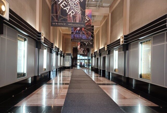
If a passage along 6½ Avenue is ever locked, gated, or closed during posted hours, that space is required by law to be open to you. You can report it to 311, and we would like to hear about it too at contact@w50s.org.
With recollections from Tama Starr, Daly Reville, and Brian Nesin of Friends of POPS.
The extension map and business map are courtesy of Friends of Privately Owned Public Space.